
KITCHEN RD
FAIRFIELD
McSWEEN RD
BELL
TOWER
YOUN
G ROA
D
GLADYS
TETON
MONTANA
AVALON
BRINX RD
McDONALD
BALLAM RD
HOPE RIVER RD
BONA VISTA
PARKING
CLARE
BUSTIN
YALE ROAD
FORD RD
ANNIS
PATTERSON
PRAIRIE CENTRAL
GIBSON RD
HWY 1
GILLANDERS
CASTLEMAN RD
CHILLIWACK CENTRAL
CHAPMAN RD
McGRATH
FERRY
OLD YALE
POPKUM RD N
ELEGY
NEVIN
PARKING
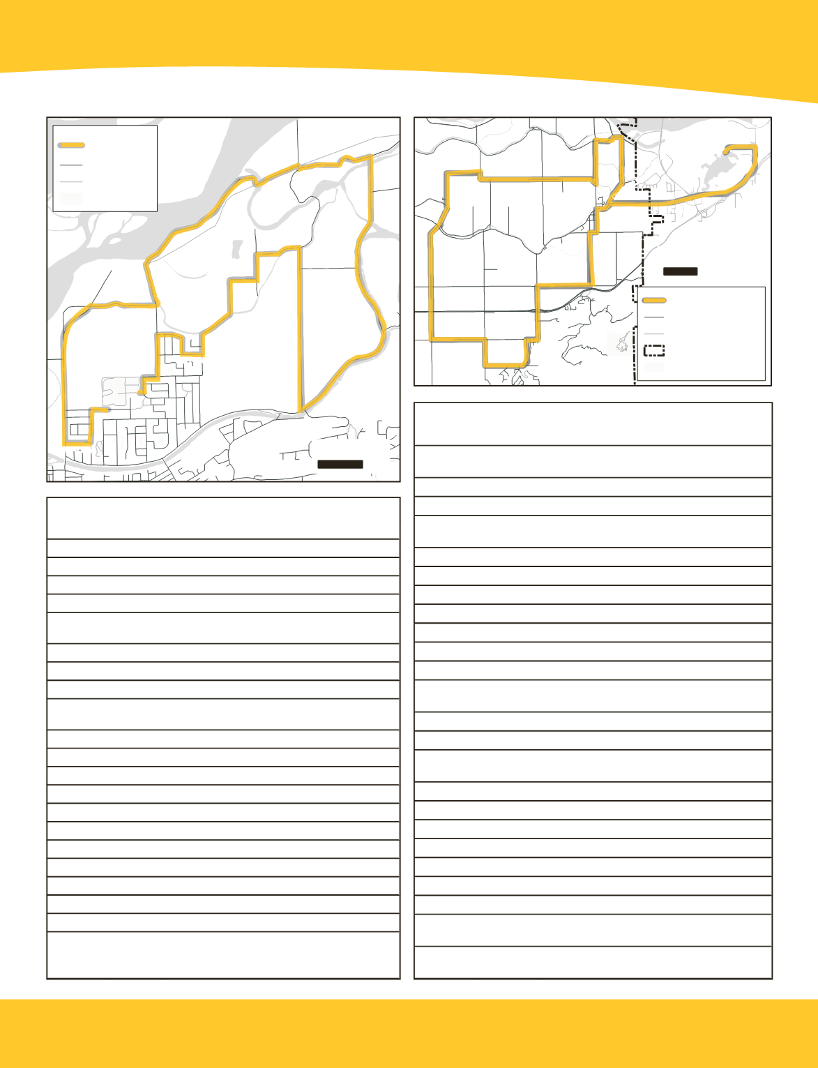
Tour de Rosedale
Total Km Distance The Route
0
CheamWetlands Regional Park. East on
Elegy Road.
0.95
0.95 Right on PopkumRoad North.
1.55
0.6 Continue straight on Yale Road East.
3.85
2.3 Continue straight through traffic circle to
cross Agassiz-Rosedale Highway.
6.45
2.6 Sharp right onto Old Yale Road.
7.3
0.85 Left on Bustin Road.
8.7
1.4 Left on Ferry Road.
9.55
0.85 Left on McGrath Road.
10.85
1.3 Right on Castleman Road.
14.65
3.8 Left to stay on Castleman Road.
15.65
1 Left on Gillanders Road.
17.25
1.6 Right on Gibson Road. Cross Yale Road East.
Cross Highway 1.
20.85
3.6 Left on Prairie Central Road.
22.45
1.6 Right on Upper Prairie Road.
23.25
0.8 Left on Patterson Road. Cycle uphill, curve to
the left for downhill.
25.25
2 Right on Prairie Central Road.
25.6
0.35 Left on Annis Road. Cross Highway 1.
27.2
1.6 Right on Chilliwack Central Road.
28.8
1.6 Left on Ford Road.
30.4
1.6 Right on Nevin Road.
30.61
0.21 Left on McGrath Road.
31.31
0.7 Right on Yale Rd East.
34.31
3 Continue straight through traffic circle to
cross Agassiz-Rosedale Highway.
38.11
3.8 Return to PopkumRoad N & Elegy Road,
starting point at CheamWetlands Regional
Tour de Fairfield Island
Total Km Distance The Route
0
Fairfield Island Park.
0.23
0.23 Right (west) on Clare Avenue.
0.42
0.19 Left on Bonavista Street.
0.77
0.35 Right on Avalon Avenue.
1.06
0.29 Right on Young Road. Across Young Road is
easy access to cafe at Minter Country
2.26
1.2 Right on Tower Road.
2.71
0.45 Right on BrinxRoad.
3.46
0.75 Left on McDonald Road.
3.96
0.5 Right on BallamRoad at the Fraser River.
Cycle along the Fraser River outside the dike.
6.16
2.2 Right on McSween Road. Cycle over the dike.
6.21
0.046 Immediate left on BallamRoad.
7.06
0.85 Right on Kitchen Road.
9.16
2.1 Continue on Hope River Road.
10.46
1.3 Right on McSween Road.
12.26
1.8 Left on Bell Road at the T-junction.
14.36
2.1 Right on Teton Avenue.
14.58
0.22 Right on Montana Drive.
15.08
0.5 Left on McDonald Road.
15.53
0.45 Right on Gladys Street.
15.88
0.35 Right on Elliott Avenue.
16.18
0.3
Straight into Fairfield Island Park. Cycle past
soccer fields & baseball diamonds to return to
starting point.
Tour de
Fairfield Island
Roads
Trails
Parks
¯
0 0.5
Km
Tour de Rosedale
Roads
Trails
City Boundary
Parks
¯
0 1
Km
SPRING/SUMMER 2016 CHILLIWACK LEISURE GUIDE
7
Recreation and Culture
A


